Morteratsch Glacier Hike
Michele and I are spending a month or so in Switzerland, to chill and to hike. This is one of our favorite hikes in the Pontresina region, climbing to an alpine hut with spectacular glacier views.
During our visit to Switzerland, we spent a week hiking around Pontresina. This was our first hike of the week. It was fantastic.
See the full photo album on Flickr
Hike Stats
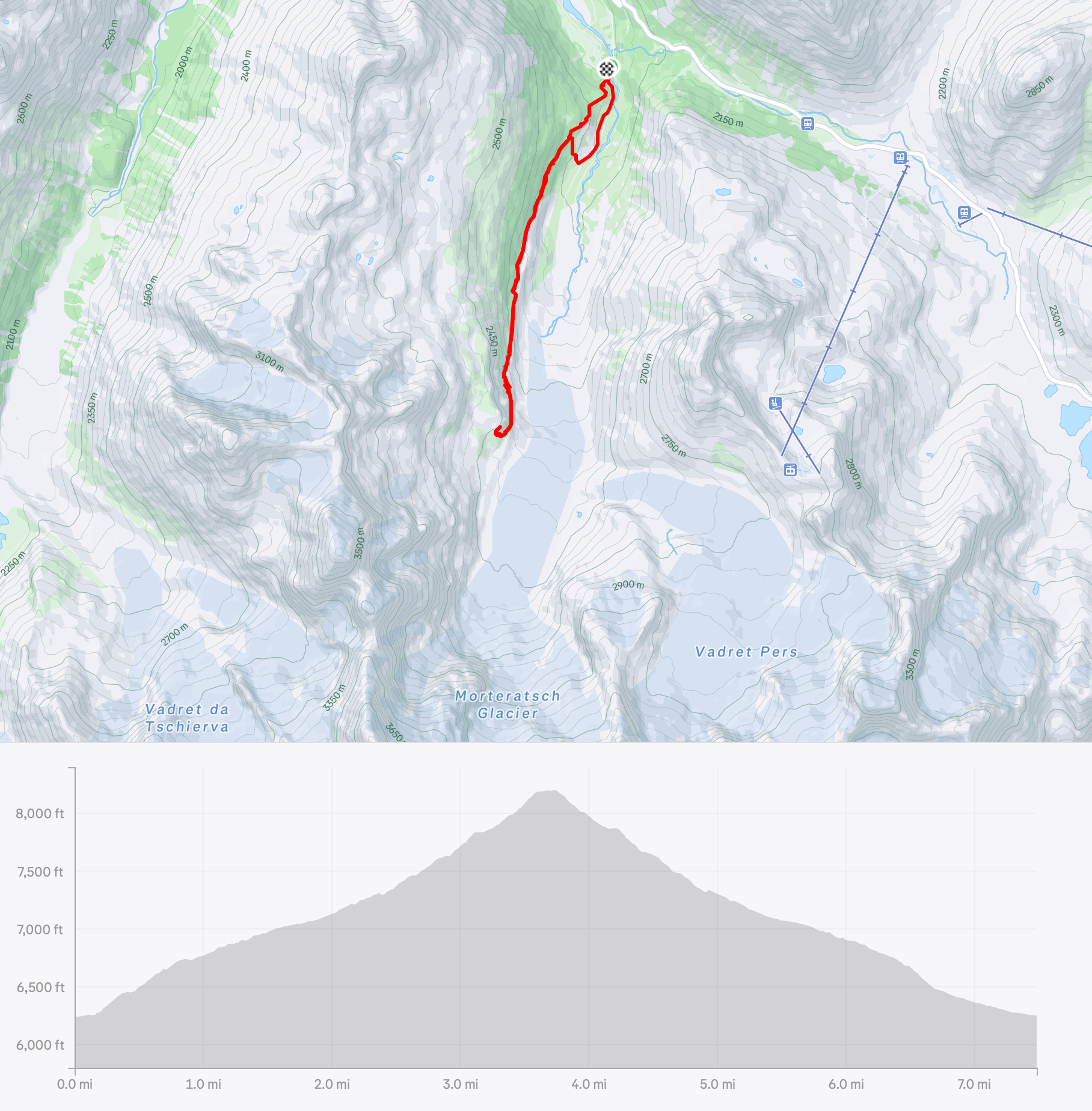
- Strava: map, route, and stats
- Trailhead: Morteratsch train station
- Trails: The route to Chamanna da Boval
- Distance: 7.5 miles
- Elevation: 6200 ft -> 8200 ft
- Hiking time: 4.5 hrs
- Weather: Overcast and cloudy, but cool
- Conditions: Trails were in great shape. Busy with people, but not badly.
Journal
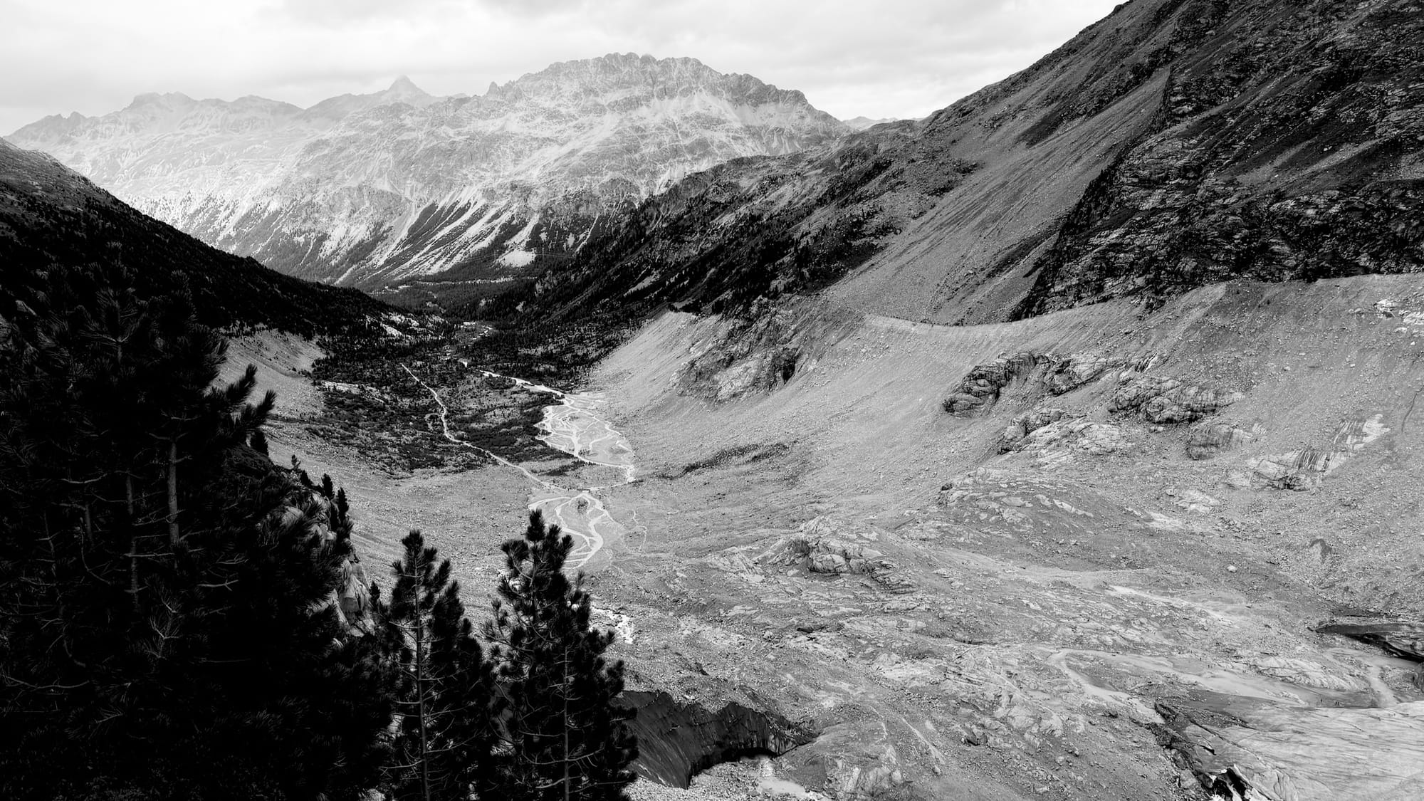
The town of Pontresina is nestled in the valley of the Bernina Pass. If you grab the train in Pontresina and start to head up to cross the pass, you'll first reach a little train stop called Morteratsch, which is at the opening of side valley that extends south toward a massive mountain range presided over by Pizzo Bernina, and dominated by the Morteratsch Glacier.
A trail starts at the train station and stays in the base of the valley, climbing slowly up to glacier. Along the way, it has signs showing how long ago the glacier extended to that point in the valley - a deeply moving indicator of the recent rapid shrinking of the glaciers.
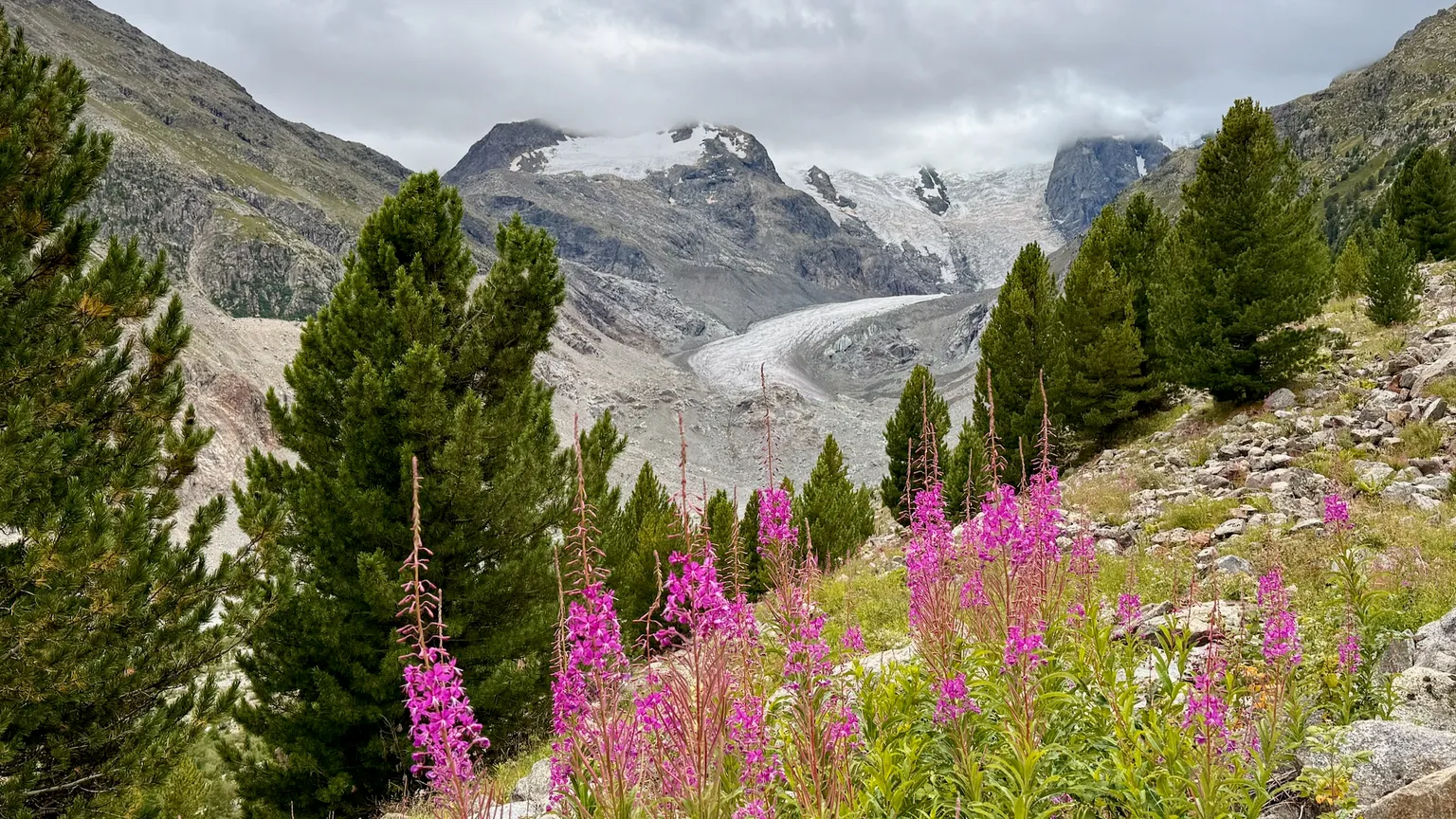
A quieter trail climbs the side of the valley to the west, eventually reaching an alpine hut and restaurant perched on the edge of a slope overlooking the peaks and glaciers in the valley.
Michele and I tried this hike in 2024 in late June, but had to turn back before reaching the hut due to snow still covering the trail. So, this year, much later in the summer, we decided to go back and try again.
This time, we made it. Passing the point where had to turn around last year felt like a minor triumph.
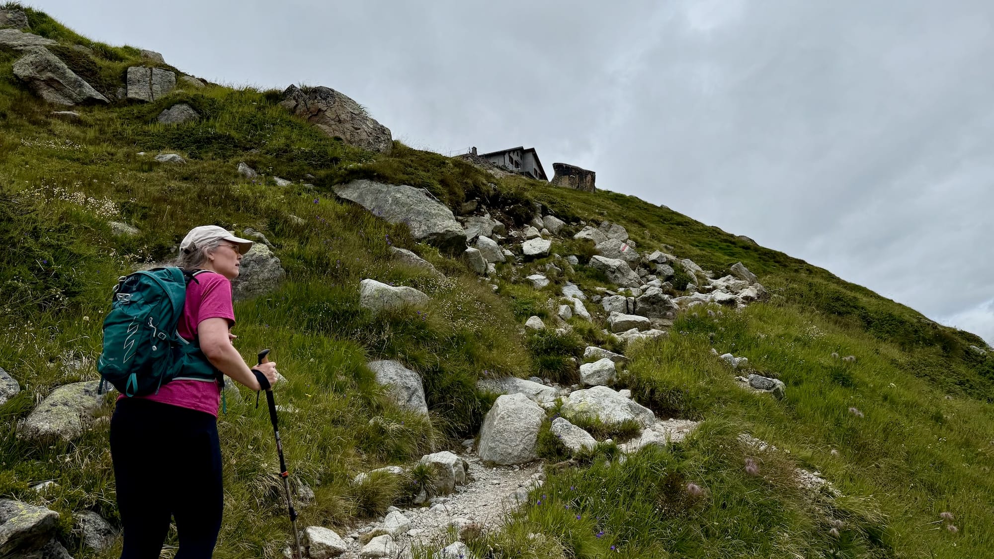
I really like this trail. It starts out at the train station where you can get things like ice cream, coffee, and bathrooms. Leaving the station, you very quickly enter the woods and walk in the shade for the first third or so of the climb, enjoying the cool. You emerge to a view of the glacier, and then continually climb up and feel the valley floor slowly sink away below you, passing small waterfalls along the way. Eventually you reach the high alpine meadows, fully surrounded by mountains on all sides, and reach the hut, where you can chill and enjoy the view while eating lunch or having a drink. And hopefully it doesn't rain on you.. which in our case, it threatened, but didn't.
From the hut, you can keep going up, but it becomes serious alpine climbing after that. We took our trail back, and then followed a side trail down to the valley floor to speed up the return and see the glacier markers.
See Also