Haute Route Hike Updates
Brian, Mark and I are hiking the 10-day long Walker's Haute Route, a legendary trail connecting Chamonix and Zermatt. These are updates from during the hike.

Starting on August 21st, Brian, Mark and I will be hiking the Walker's version of the legendary Haute Route (see Wikipedia) that goes from Chamonix, France to Zermatt, Switzerland.
See my Haute Route Overview for more background info.
I'm not sure how much network access and time to write that I will have on this hike. If I do have enough of each, I will be updating this page.
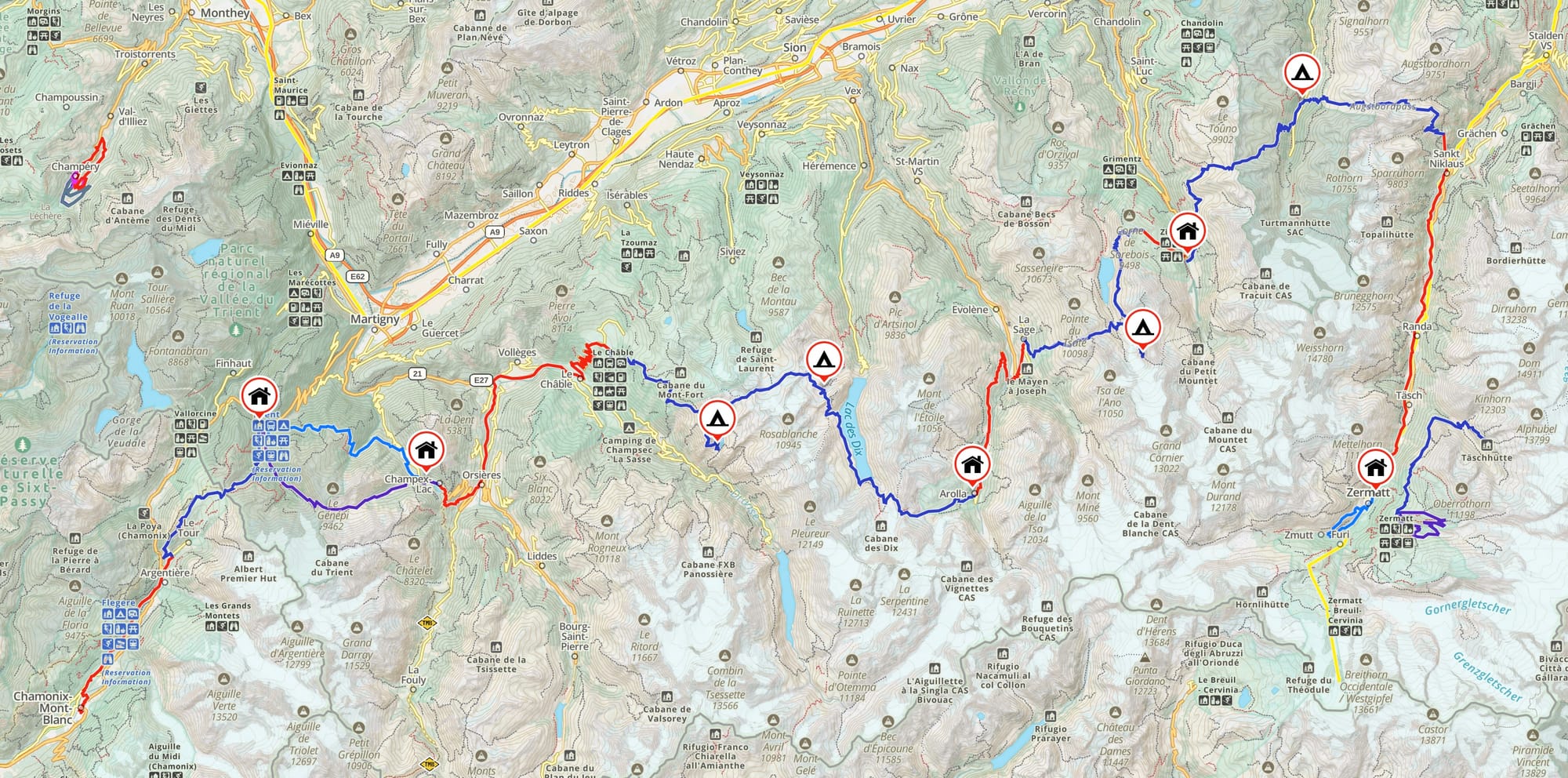
Map
Here's a high-level map showing the entire route. It starts in Chamonix in the lower left, works its way east, and ends in Zermatt, on the right side of the map.
The blue lines are the walking trails between stops. The red lines are the places we'll be grabbing a bus, taxi, chair lift, etc.
The icons with houses and tents are the places we'll be stopping. Houses are inns - with power, showers, guest rooms, and road access. The tents are alpine huts, way up in the peaks - with food, maybe power, and probably dorm-style sleeping.
Day 0: Arrival in Chamonix
Day 1: Chamonix to Trient
Day 2: Trient to Champex
Day 3: Champex to cabane Louvie
Day 4: cabane Louvie to cabane Prafleuri
Day 5: cabane Prafleuri to Arolla
Day 6: Arolla la Sage to Moiry hut
Day 7: Moiry hut to Zinal
Day 8: Zinal to Gruben
- Story and pix
- No hike details - zero day
Day 9: Gruben to St Niklaus
Day 10: Täschalp to Zermatt
Epilogue Day above Zermatt:
Post-hike Retrospective:
See Also
- Haute Route overview
- Photos and stories from the other chapters of our 2025 Swiss trip

